Home » Travel Guides » Sapa Vietnam Elevation: How High Is It Really with Sapa Tours?
Sapa Vietnam Elevation: How High Is It Really with Sapa Tours?
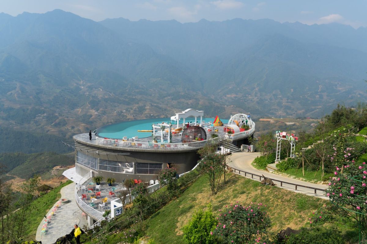
Located in Lao Cai province, Sapa, Vietnam, is situated at 1,500–1,800 meters above sea level, with cool climatic conditions, majestic landscapes, and unique ethnic cultures. The stunning Sapa Vietnam altitude offers ideal weather for trekking, health resorts, and outings to Mount Fansipan, the Indochina peak at 3,143 meters. It is perfect for travelers who want to experience nature, heritage, and fresh mountain air. Organize your travel with Impress Travel, your trustworthy Sapa tourism specialist.
Sapa Vietnam Elevation – The Numbers and the Impact
How high is Sapa above sea level?
Numbers, let’s talk about! Sapa, Vietnam’s elevation ranges between 1,500 and 1,800 meters above sea level. Because of its height, Sapa has a year-round cool climate, usually with foggy mists in the mornings and bright blue skies in the afternoons. The crisp air, panoramic view of the valleys, and peaceful surroundings are exactly why this mountain town is so endearing.
As a result of this increase in Sapa, Vietnam is perfect for nature lovers, hikers, and people who wish to escape the summer heat. Mild altitude sickness symptoms in Sapa, Vietnam, are felt by a few tourists, especially if they come quickly from cities like Hanoi in the lowlands.
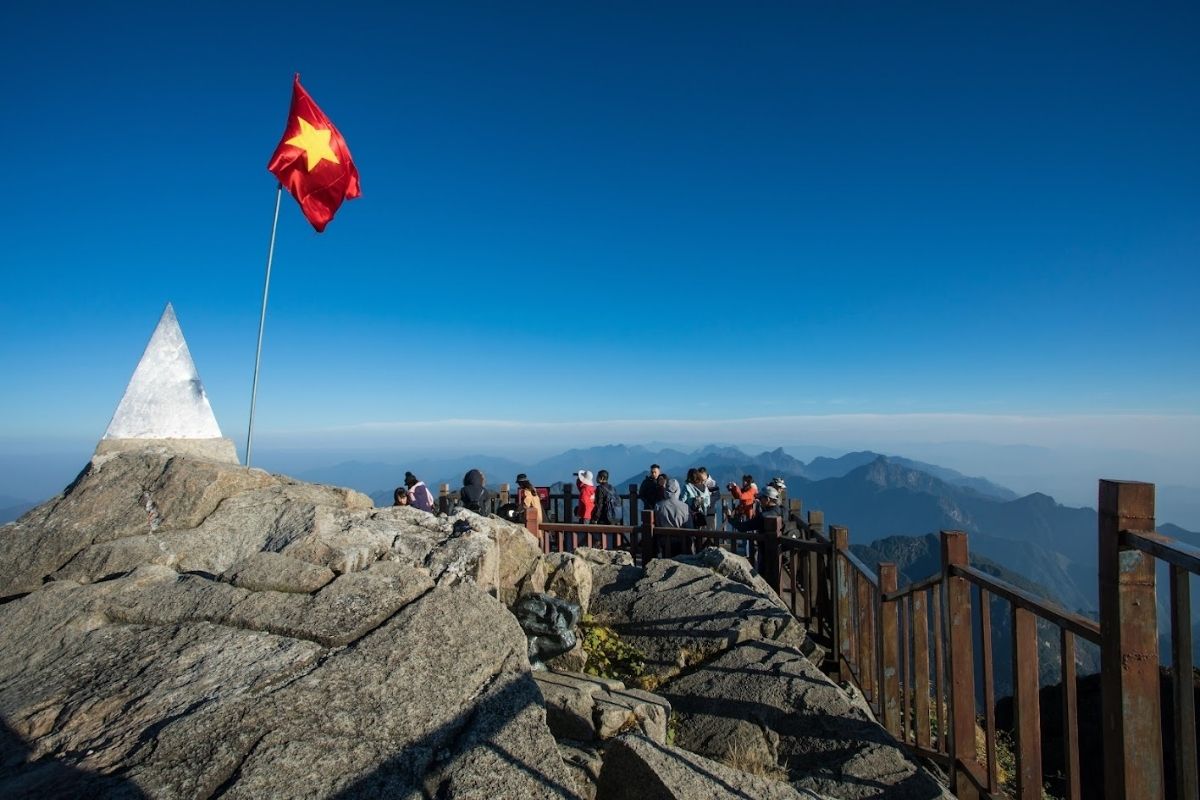
What is the name of the mountain in Sapa?
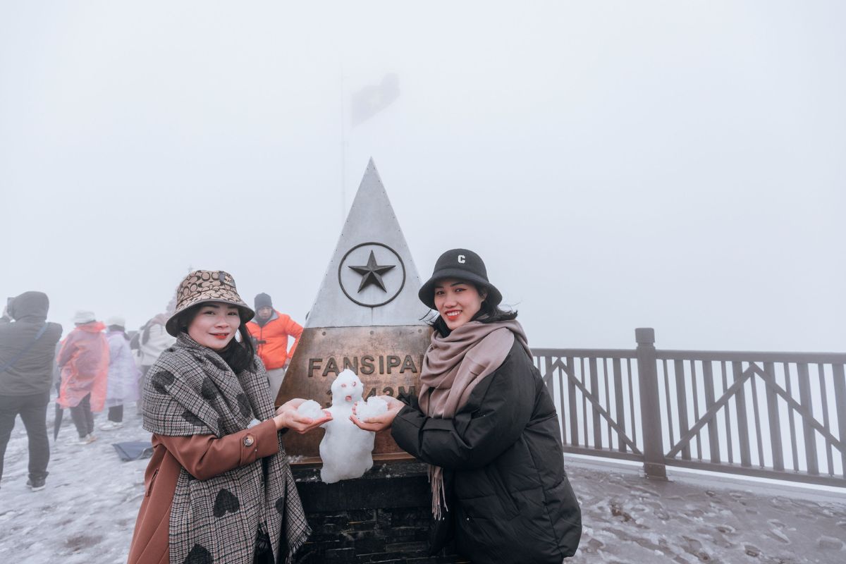
You were correct – it’s Mount Fansipan, or Phan Xi Pang, and at a height of 3,143 meters. That’s right — this is Vietnam’s highest point and the highest point in Indochina!
Nicknamed the “Roof of Indochina," Fansipan is more than a mountain peak. It’s a symbol of the nation, having both pristine wildness and cultural depth. There are indigenous legends of powerful mountain spirits, and current-day visitors climb it to see otherworldly dawn views above the clouds.
Exploratory? Trek to the top in two days. Prefer comfort? Cable car up to Sun World Fansipan Legend in 15 minutes! Next, find pagodas, giant Buddha statues, and mountain temples in rolling fog.
Fansipan Peak (Source: vietjetair)
What Makes Sapa’s Altitude Special?
Unique Microclimate Created by Elevation
What sets the Sapa Vietnam elevation apart isn’t the figures — it’s the weather that comes with it. At 1,500 to 1,800 meters above sea level, Sapa has a temperate, cool climate year-round — something that doesn’t happen often in tropical Vietnam.
The average temperature is 15°C year-round, with refreshing days and cold nights.
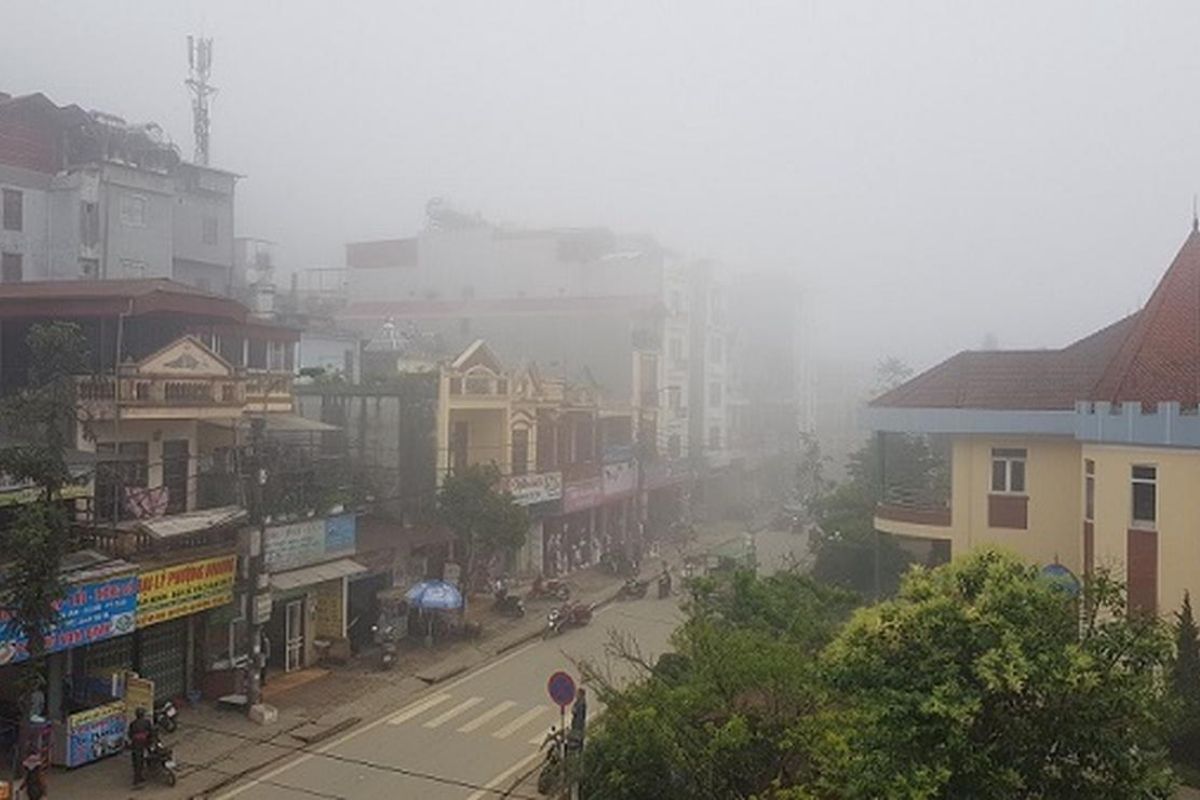
As a result of the emergence of Sapa Vietnam, fog and clouds usually cover the town in the morning or the evening, creating a mystical and peaceful atmosphere.
The lower temperatures also move visitors away from the heat and humidity of the lowlands, and they also render Sapa suitable for recreation and medical tourism.
Fog Covers Sapa Town (Source: thanhtra)
Changing Landscapes with Altitude
Sapa’s altitude doesn’t just affect the weather — it shapes the landscape at every scale. The higher you go, the landscape, vegetation, and perspective change noticeably:
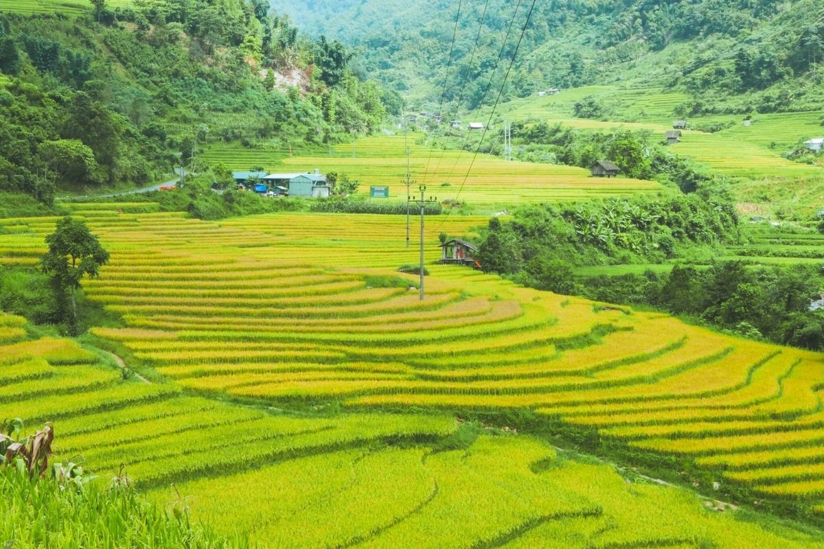
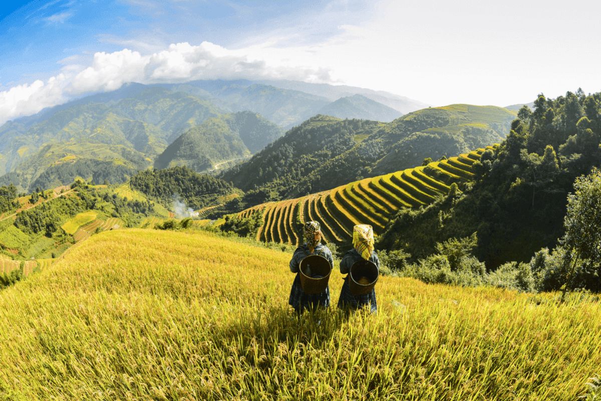
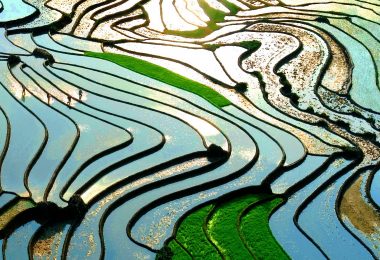
Low altitude regions (1,000–1,400m): This is where the mythical rice terraces, especially in villages like Lao Chai and Ta Van, are located. Minority groups cultivate these levels of emerald and gold fields and are viewed best between August and October.
Terraced Fields are Low Elevation Areas (Source: dantri)
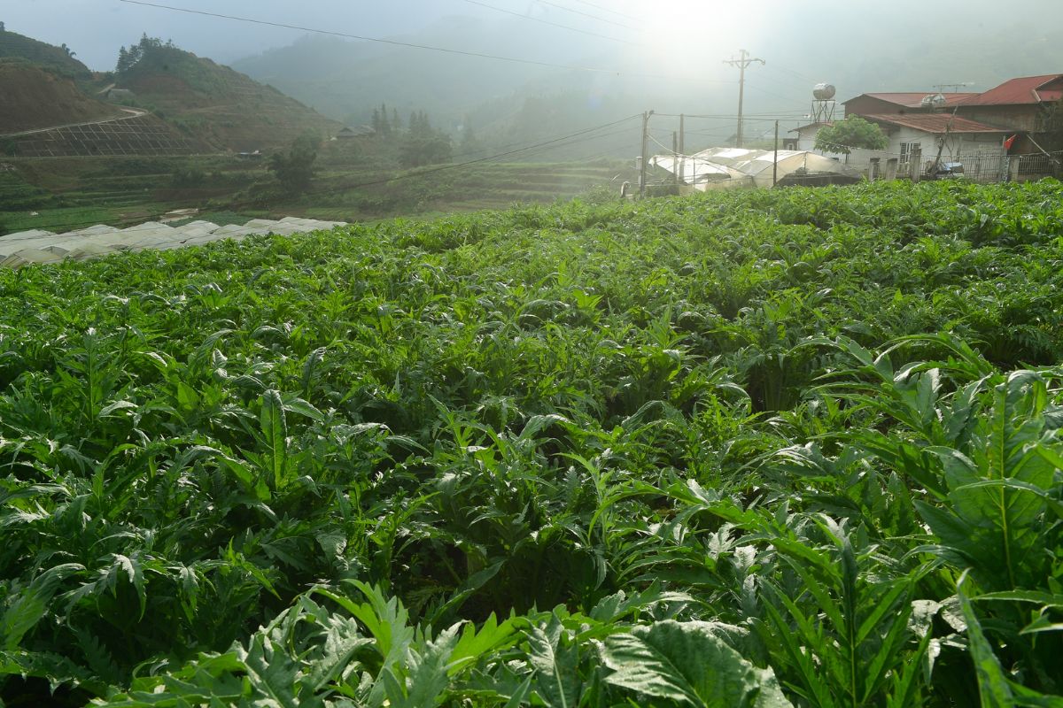
Mid-elevation regions (1,500–2,000m): Pine forests, bamboo forests, and herb fields dominate this zone. It is also home to some of the best trekking routes in Sapa, where ethnic culture and nature blend perfectly.
Average Altitude of Sapa Herbal Fields (Source: afamily)
High altitude areas (above 2,000m): Approaching Fansipan – Indochina’s highest point – the views shift to rocky mountains, alpine scrub, and a sea of clouds. This is where you truly enjoy the impact of altitude, Sapa, Vietnam: crisp air, breathtaking scenery, and the peaceful hum of nature just above the forest line.
Rocky Peaks and High Mountain Bushes (Source: nguoidothi)
Wildlife and Flora Adapted to Altitude
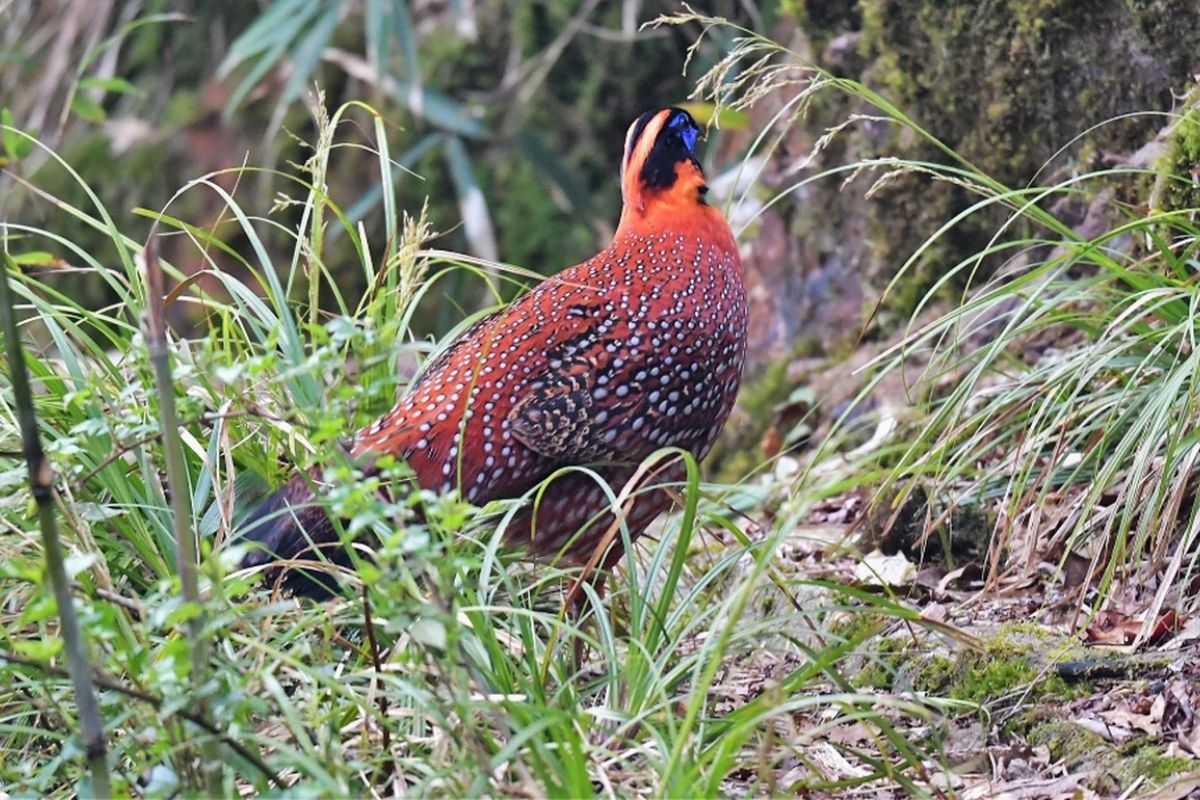
The diverse height of Sapa, Vietnam, also fosters a wide range of unique flora and fauna, especially in Hoang Lien National Park.
Fansipan’s steep slopes support over 2,000 types of vegetation, most of them endemic to the region. There are orchids, medicinal herbs, and alpine mosses that exist only at high altitudes.
Animal life here includes birds like the green-tailed sunbird, macaques, and even Asiatic black bears that keep to themselves. The flora and fauna have acclimatized to the thinner atmosphere and reduced temperature that come with Sapa Vietnam’s highland elevation.
The herbal remedies of the area, such as the medicinal baths of Red Dao, rely on highland plant life — vegetation available only at specific elevations.
Animals in Hoang Lien National Park (Source: dantri)
How Sapa’s Altitude Affects Your Travel Experience
Altitude Sickness in Sapa with Sapa Vietnam Elevation – Should You Worry?
The Sapa region of Vietnam is beautifully perched at a high altitude, but one that your body may sense, especially if you’re coming from sea level.
Who might be affected? Most travelers will be fine, but some people may experience mild symptoms when going over 2,000 meters, for example, when traveling to Mount Fansipan. This is where the Sapa Vietnam elevation is more noticeable.
Common symptoms of Sapa Vietnam elevation sickness include:
Mild headache
Dizziness or lightheadedness
Shortness of breath (especially when climbing stairs or inclines)
Fatigue or sleeplessness on the first night
These are symptoms of the thinner air at high altitude. They’re not dangerous, but they may affect your comfort.
Prevention tips:
Stay hydrated – drink plenty of water throughout the day.
Ascend gradually – spend your first day hiking around Sapa Town (1,500m) before heading to the Fansipan summit (3,143m).
Take breaks – rest if you’re fatigued. The high-altitude Sapa, Vietnam, needs your fresh energy.
Avoid alcohol on the first night — it will worsen symptoms.
Clothing, Health & Gear Tips Based on Altitude with Sapa Vietnam Elevation
Because of Sapa Vietnam’s altitude, the temperatures can shift quickly throughout the day — cold mornings, hot afternoons, and cold nights.
What to pack for cold nights and foggy mornings:
A warm jacket (especially from October to March)
Long-sleeve shirts and thermal layers
A water-resistant outer layer (in case of unplanned rain)
Hat and gloves in the winter months
A face mask or scarf — mornings are misty and windy
Best footwear for highland trekking:
Sturdy walking shoes or trail running shoes with good grip
Avoid open-toe sandals when hiking in the forest or terraced fields
If visiting Fansipan, bring comfortable walking shoes for climbing and stairs
Weather by Elevation: Month-by-Month Snapshot for Sapa Vietnam Elevation
Because of the Sapa Vietnam altitude, each season in Sapa feels unique. Here’s what you can expect:
Spring (Feb–May): Blooming Season
Average temp: 10–20°C
Plum blossoms, peach flowers, and fresh green rice shoots burst forth on the hills.
Perfect time for light trekking and photography.
Take Pictures with Plum Blossoms (Spurce: ticotravel)
Summer (Jun–Aug): Cooler Escape, Rainy Season
Average temp: 18–25°C
While the rest of Vietnam is baking, Sapa remains cooler thanks to its altitude.
Expect intermittent rain and lush green landscapes. Bring rain-proof gear!
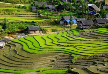
Autumn (Sep–Nov): Golden Rice Fields
Average temp: 12–20°C
Most scenic time of the year: vivid golden terraces and clear blue skies.
Ideal time for trekking and ethnic village visits.
Golden Rice Fields (Source: viettrekking)
Winter (Dec–Feb): Snowfall Above 2,000m
Average temp: 5–15°C, sometimes below 0°C at Fansipan summit
Sapa, Vietnam’s high altitude, allows rare snow or frost to occur.
Bring thick jackets, gloves, and heat packs if you visit at this time.
Snow Falls on Fansipan Peak (Source: thanhnien)
Elevation-Based Activities to Enjoy in Sapa with Sapa Vietnam Elevation
Trekking Across Terraced Landscapes with Sapa Vietnam Elevation
Thanks to the Sapa Vietnam elevation, the region offers some of the most scenic and climate-wise pleasant hiking trails in northern Vietnam. The following are the top trails with their destinations and elevations:
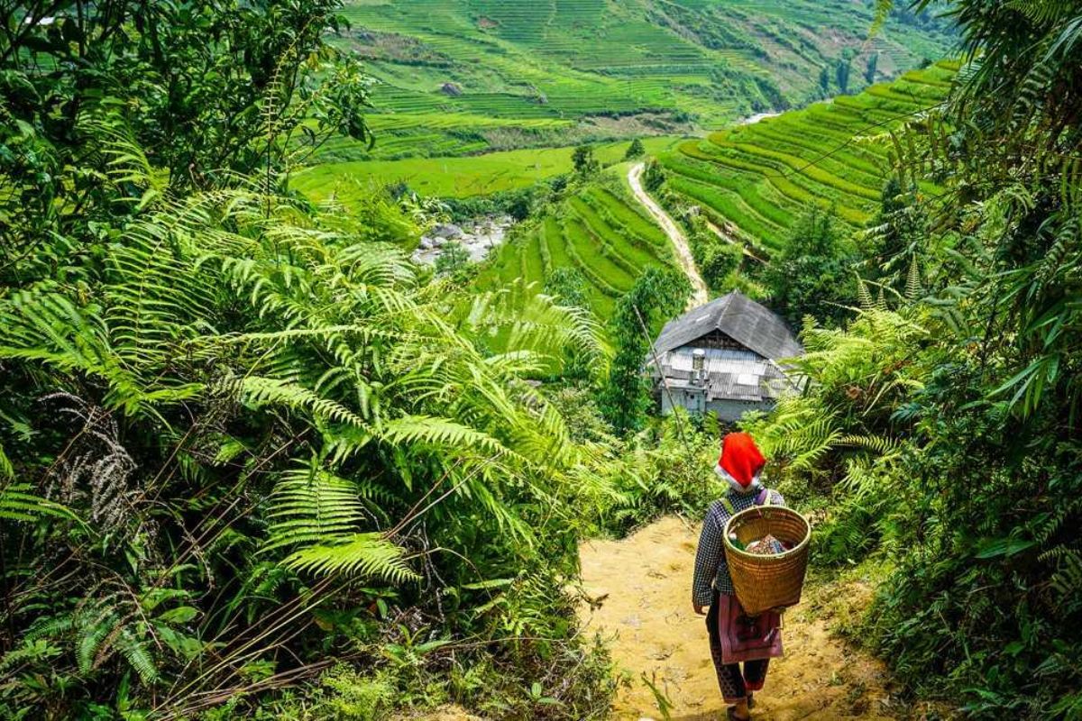
Y Linh Ho Village – Located in Lao Chai Commune, about 7 km from Sapa town. Altitude: ~1,500 meters: A walking path with stone trails, mountain slopes, and overlooking terraced rice paddies.
Lao Chai – Ta Van Trail – Start from Lao Chai Village and walk through Ta Van Village. Altitude: 1,300–1,500 meters. The most visited route, which is easy and appropriate for beginners, offers interaction with Hmong and Giay ethnic families.
Sin Chai Village – Located in San Sa Ho Commune, 4 km from the town center. Altitude: ~1,600 meters. Less touristy and more rugged, suitable for travelers seeking quiet nature walks and an off-the-beaten-path experience.
Trekking Across Terraced Landscapes (Source: vietbao)
Homestay in the Highlands: Altitude & Authenticity with Sapa Vietnam Elevation
Night stays in highland villages are the best way to experience the actual impact of Sapa Vietnam’s altitude, both in climate and local lifestyle.
Top homestay areas by altitude:
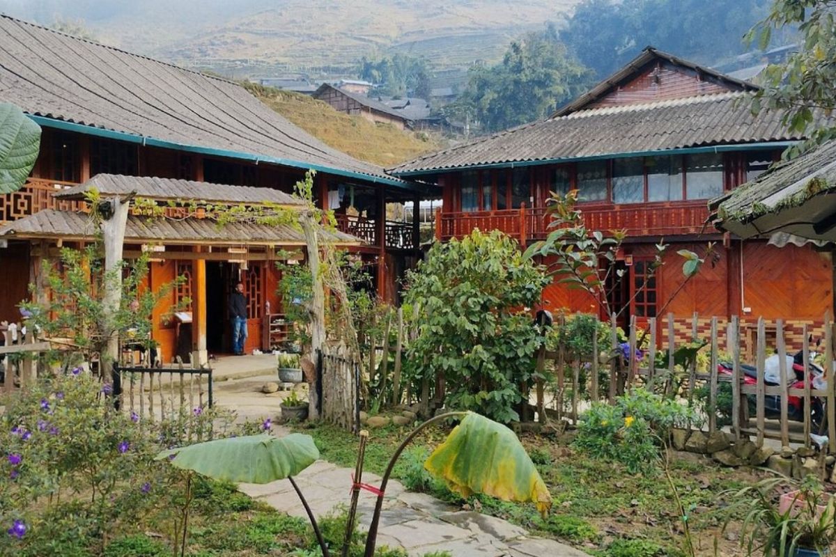
Ta Van Village – 9 km southeast of Sapa Town. Altitude: ~1,400 meters: Famous homestays are Tavan Ecologic Homestay, Zizi Homestay, which provide ethnic meals, herbal baths, and cozy family stays.
Giang Ta Chai Village – Situated deeper in the woods, further than Ta Van. Altitude: ~1,600 meters: Suitable for those who seek a peaceful, nature-filled getaway.
Su Pan Village – A higher village at 1,700–1,800 meters, with sweeping valley views and untouched Red Dao culture: Homestays here offer deep cultural immersion and fewer tourists.
Due to Sapa Vietnam’s high altitude, the temperature in these places can drop at night, even in the months from December to February. Wear layered clothing, and don’t forget to bring socks and gloves to stay warm.
Homestay in the Highlands: Zizi (Source: sapanomad)
Adventure Photography at High Altitude with Sapa Vietnam Elevation
High-altitude Sapa, Vietnam, offers photographers a great range of scenery — from mountaintop cloudscapes to valley mist. Top photo spots are listed here in order of elevation:
Muong Hoa Valley – 8 km southeast of Sapa Town. Elevation: 1,000–1,400 meters. Rice terraces, streams, and ancient rock carvings are the standouts. Morning mist adds a dramatic layer.
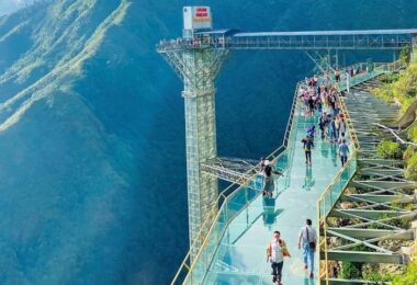
O Quy Ho Pass – On Hwy QL4D, about 15 km west of Sapa. Altitude at the top: ~2,000 meters. One of the highest mountain passes in Vietnam. It’s possible to stop at the top to take pictures of clouds passing through the peaks.
Infinity Garden (Vuon Vo Cuc) – Near Sun World Fansipan Cable Car Station, at ~2,800 meters: A platform specially designed for panoramic photos. When the day is clear, you’re above the clouds with nothing to block your view of the Hoang Lien Son range.
Infinity Garden (Source: trulysapa)
Conclusion
In short, Sapa’s unique appeal lies in its breathtaking landscape, moderate climate, and cultural diversity — none of which would be possible without the majestic Sapa Vietnam altitude. Whether it’s trekking through rice paddies, overnighting at highland homestays, or climbing Fansipan, Sapa, Vietnam’s altitude lends a cool touch to every activity. For a smoothly arranged, stress-free vacation, let Sapa tourism by Impress Travel bring your trip above the clouds.
Frequently Asked Questions
1.How many directions are there in Sa Pa town?
Sa Pa town contains six main directions, which lead to the primary valleys and surrounding villages such as Muong Hoa, Ta Phin, Cat Cat, Sanh Chai, Ban Ho, and the O Quy Ho Pass area. There a various cultural activities or trekking in each direction.
2.Where is Sa Pa?
Sa Pa is located in Lao Cai Province, northwest Vietnam, about 317 kilometers from Hanoi. It lies in the Hoang Lien Son mountain range, near the border with China.
3.How high is Sapa above sea level?
The Sapa Vietnam elevation is 1,500 to 1,800 meters above sea level, one of the highest in Vietnamese towns and a popular retreat owing to its chilly climate and mountainous terrain.
4.What is the name of the mountain in Sapa?
The most well-known mountain in Sapa is Mount Fansipan (Vietnamese: Phan Xi Pang), which stands at 3,143 meters. It’s the highest point in Vietnam and all of Indochina and is commonly called the “Roof of Indochina."
Ranana
You feel like organized tour, but you are in a privet tour. Impress Travel make the different.
We went on a private trip to Vietnam and Cambodia, the whole trip plan was organized for us by the Impress Travel Company from Vietnam, the company did an amazing job, the whole trip was organized in a wonderful way with an amazing match between the various parties, their choices were correct and the quality of the hotels chosen were very high quality and it is important to note that the price was low in comparison To other agencies, thanks to Impress Travel and especially to Daniel who was tolerant and open to changes and organized the route for us.
Ebrahim
Tour of Vietnam
Impress travel were amazing. Did my bookings with Daniel for our tour of Vietnam and I must say Daniel was very professional and prompt with his services. All the arrangement, plans, pick-up & drop-off services, hotels, vehicles, sightseeing tours and guides were spot on and excellent. Did 4 nights Hanoi, 1 night Hà Long Bay cruise, 3 nights Hoian, 4 nights Saigon and 1 night in Can Tho. It was totally awesome. Every part of the journey was superbly arranged and planned. I will highly recommend Impress Travel for anyone interested in visiting Vietnam. Very organized and reliable!
Solly Pochee
The tour was fantastic
I booked with Impress Travel in July. My contact person was Tommy Thang. He is an amazing person. He was very helpful. He changed my program twice for me. Very accommodating! We started our holiday in the north (Sapa)of Vietnam and travelled down to HCMC. The tour was fantastic, Tommy's arrangements were to the"T". I will always use them if I have to visit the area again and recommend them to one and all. Thank you once again Mr.Tommy and the Impress Team. Sulaiman Pochee
Bernard Lim
Great value for money with 4 stars hotel
Great value for money with 4 stars hotel accommodation for 4 couples. The tour guide has been very helpful and brought us to amazing places in Sapa. We want to thanks Thuy the tour guide and especially Mark from Impress Travel for his great service and assurance throughout our trip. We’ll definitely use his service for other tour packages in other parts of Vietnam.
Derek.Schooling
We enjoyed our holiday with Impress travel
This is the second time we travel to Vietnam with IMPRESS Travel. First time, we booked our holiday to Hanoi, Halong Bay & Sapa during Dec 2018 with Impress. Second time, we travel to Hoi An, Hue & Danang (Central Vietnam) during Jan 2019.
My friends & I are very glad & happy with all the hotels stay in Central Vietnam, the meals provided are delicious. We are greatly appreciated with all the tour arrangement by Tommy & his team (tour guide). Especially, Mr. NHAT C.V. He is helpful, cheerful, knowledgeable and very professional. He always volunteer to take a nice pictures for six of us (group) .
We enjoyed our holiday with Impress travel. We will definitely come back to Vietnam again with Impress
CHECK PRICE & AVAILABILITY - BEST QUALITY GUARANTEE
An amazing sapa tour to admire the dramatic scenery of Sapa Hill Station in the northwest of Vietnam such as imposing rice terraces, stunning green valleys, hills row on hills, mountains of mountains.
Three days of Sapa easy trekking to explore the most iconic attractiveness of Sapa such as rice terraces, lush-green valleys, imposing mountains rows of mountains, the cultural diversity.
To do the athletic activities as easy trekking to visit the rustic hill tribe villages via the stunning rice terraces, to meet at the friendly communication with local ethnic people, enjoy local foods.
The tour bring you to Sapa easy trekking tour to ethnic villages & O Quy Ho Glass bridge where travelers floating experience by the imposing scenery around and the deep smoking bottom.